Today we decided to retrace the Green Mountain Railroad Trail one last time and followed west Street Ext. up into Acadia National Park. We got about to the area of the Great Hill trail along the Park Loop road when we came upon some roadwork being done.
 |
| park loop road - acadia national park |
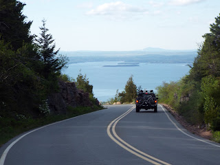
We continued walking along the Park Loop Road, stopping to rest by the entrance to the Cadillac Mountain Summit road - a lot of traffic seemed to be heading up the summit road.
 |
| second pullover |
When we reached the second pull over we took another break before crossing the road and entering the woods. Years ago it was hard to see where the trail began, but today enough people have used it so the ground was pretty worn down. Up the banking from the road it turns left and quickly comes to a rock placed by the first railroad spike - very easy to locate.
From there the trail turns right and heads upward into the woods, with a number of railroad spikes in plain sight. It was clear an attempt was made at one time by rangers or Ridgerunners, to bend some of the spikes so they didn't stick upward, as you will see in the photo - most likely a sledge hammer was used in an attempt to make it harder for people to find the old abandoned trail.
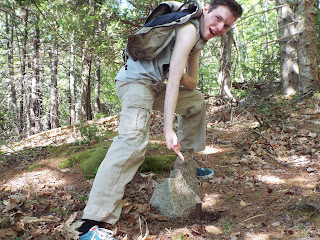 |
| RAILROAD SPIKE ON CADILLAC MOUNTAIN - ACADIA NATIONAL PARK |
Yeah, I know, this was never a hiking trail, but once the Railroad company went out of business it did become a hiking trail for many years after.
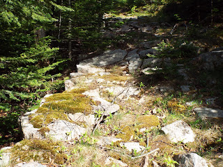
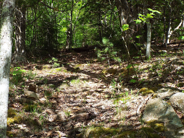
The trail is pretty much a shallow ditch, much like a dried up brook, keeping that in mind makes it easy to stay on course as you make your way through the woods. In the photos you can see what I mean.
There was a few spots where a bush or small tree grew up in the trail but mostly it was pretty open.
 |
| GREEN MOUNTAIN RAILROAD TRAIL - ACADIA NATIONAL PARK |
We did have to step over a few downed tree's along the way and as we went along we came upon a number of rock piles, half were still up and half had been taken down - clearly a war of sorts if going on along the trail between Ridgerunners and trail phantoms.
Next to some of the iron spikes sticking up out of the ground we saw a number of spikes that had been removed and are piled there rusting away, as you can see in the photo.
 |
| PHANTOM ROCK PILE - ACADIA NATIONAL PARK |
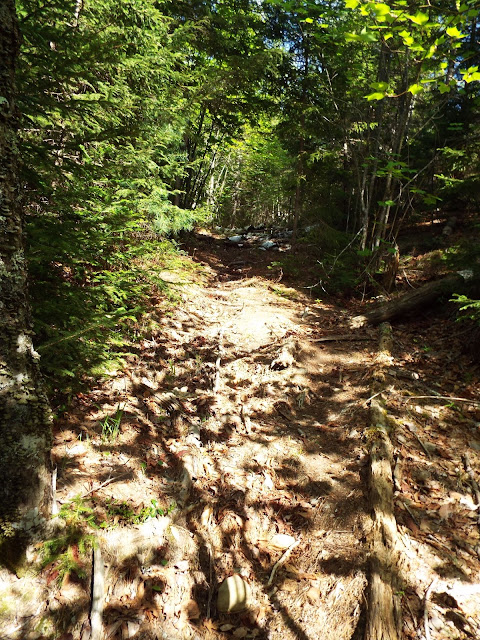
This was the only time I have ever hiked this trail when the granite was dry and not slippery so footing was not a problem. Before long we came to my favorite area of the trail, a long section that had been built up so workers could lay down tracks. Beyond that area the trail follows a wall of boulders for a ways before taking a slight right hand turn and moving up through the woods.
As you begin to pass through open granite areas and re-enter the woods, you encounter more and more brush growing up in the trail, but some railroad spikes are never far away to help guide you along, that or rock piles.
 |
| GREEN MOUNTAIN RR TRAIL UP CADILLAC MOUNTAIN - ACADIA |
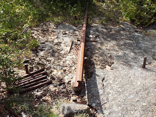
About three forths of the way up the trail we came to my second favorite place along the trail, the section where the one and only remaining piece of steel rail still rests. It is a beautiful sight to come upon after battling blackflies for much of the way - yeah, once again we forgot to carry the insect repellent.
 |
| BUILT UP SECTION OF RAILROAD TRAIL - ACADIA |
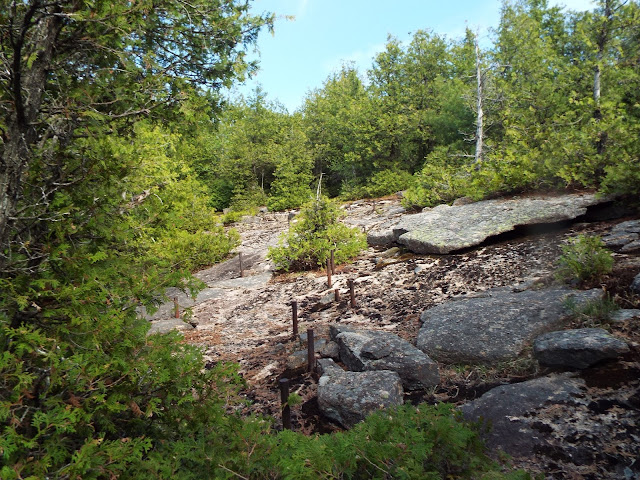
From there you will move across open granite, back into the woods, back across open granite, and so on, with the open granite having many railroad spikes.
 |
| RAILROAD SPIKES GUIDE THE WAY - ACADIA |
The final stretch of trail moves through brush and becomes much harder to follow, but it does follow a brook at times moving right through the center of it. Today the brook was bone dry so we were able to follow the spikes all the way to where it comes out on the Cadillac Summit Road.
 |
| GREEN MOUNTAIN RAILROAD SPIKES - ACADIA NATIONAL PARK |
Right there on one of the granite blocks found along the roadway was a stone, across the roadway was two more stones showing where the trail continued on the other side of the road.
 |
| LAST REMAINING SECTION OF RAIL - ACADIA NATIONAL PARK |
I have never attempted to follow the trail on that side of the roadway, since where the trail crosses the road is pretty clost to the summit of Cadillac.
Back when the train was running it would of gone pretty close to the summit, stopping close to a motel, and I have heard that the old foundation is still visible. It would of been nice to go all the way to the summit, but we were hungry and so were the swarms of blackflies around us, so we walked back down Cadillac Mountain following the Summit road and headed back home.
 |
| RAIL AND SPIKES - CADILLAC MOUNTAIN - ACADIA NATIONAL PARK |
In summing up the trail today,
I would say that years ago the first half of the trail was the hardest section to follow and the top half was the easiest to follow.
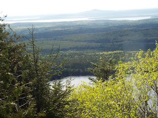 |
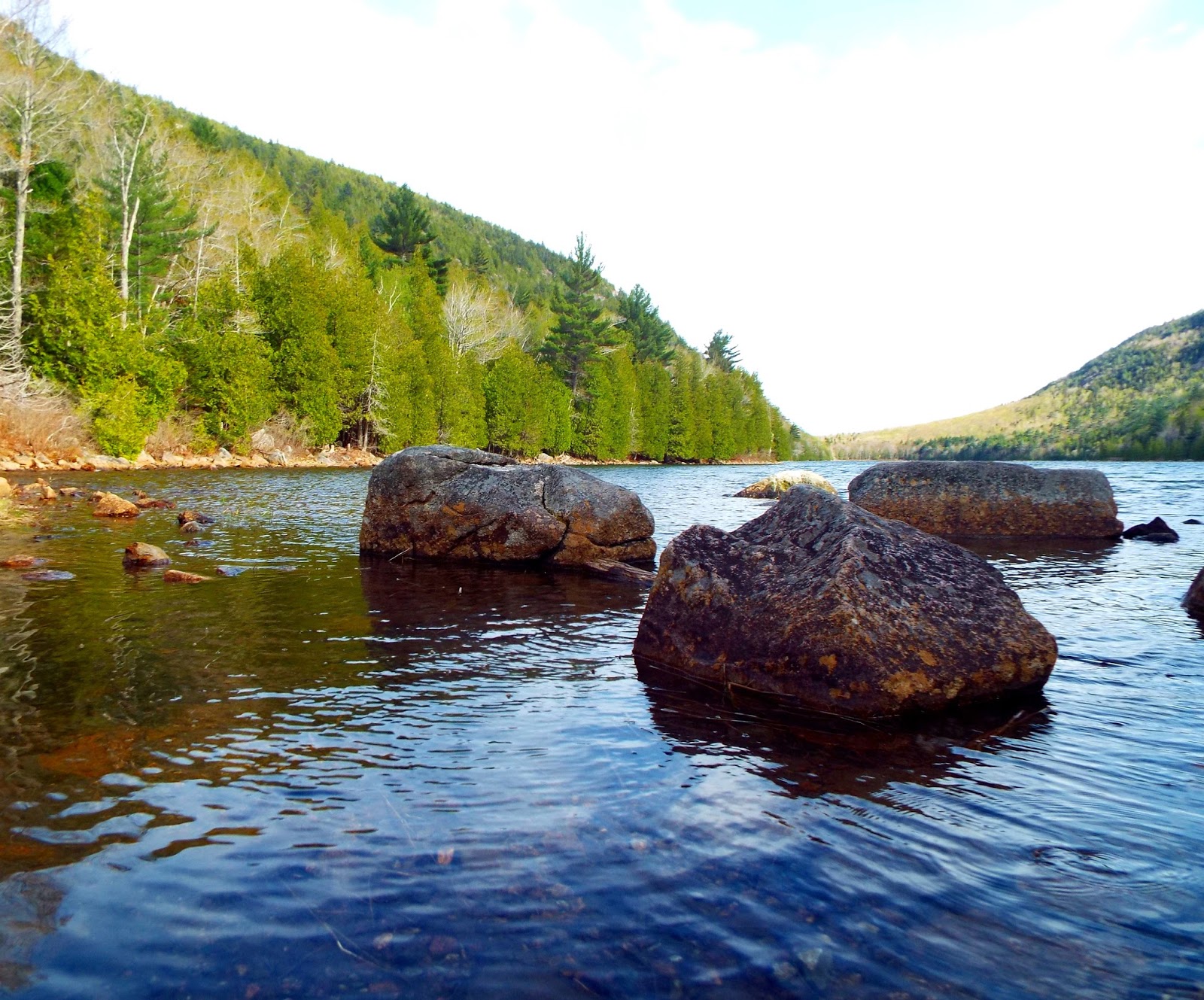
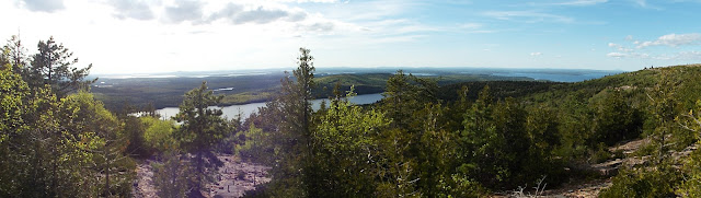
| EAGLE LAKE AS SEEN FROM RAILROAD TRAIL - CADILLAC MOUNTAIN, ACADIA |
Today it is the bottom half that is easiest to follow and the top half has become more and more overgrown in sections.
When I first began hiking this trail many years ago I always had an approach to doing it which works well today.
 |
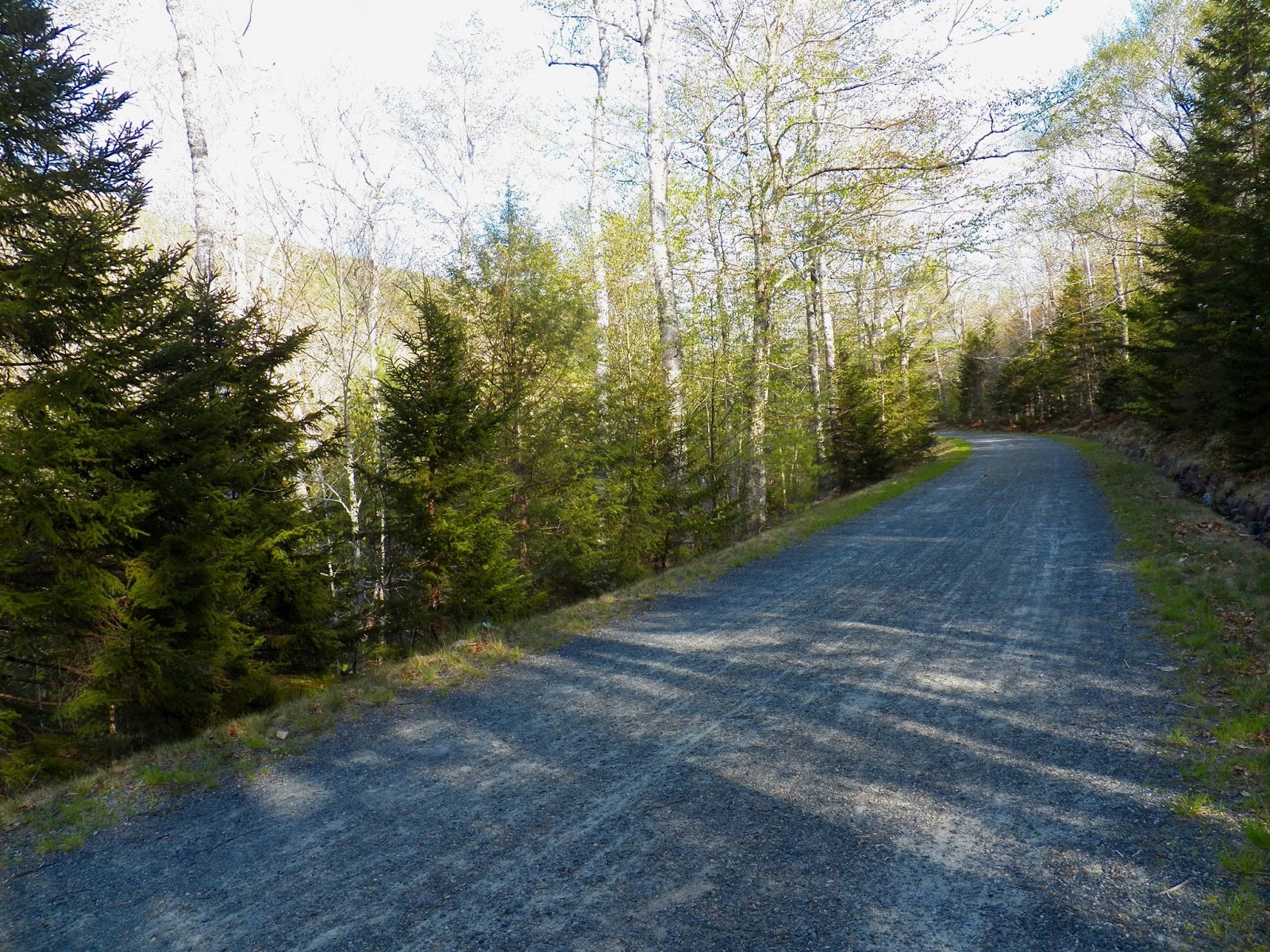
| CADILLAC MOUNTAIN SUMMIT ROAD - ACADIA NATIONAL PARK |
Hike with one or two others and when you reach a section that becomes hard to follow, have someone go ahead and zig-zag in search of the next railroad spikes or rock piles. Of course, the top section is not far from the Cadillac Summit road and you can hear cars on the roadway not far off, so the risk of becoming lost is pretty slim.
 |
| CADILLAC SUMMIT ROAD - ACADIA NATIONAL PARK |
The one thing I would add is that when ever we have hiked this trail we hike up it and follow the Cadillac Summit road back down. There are just too many spikes sticking up out of the granite and moving downward I think it would be a lot easier to trip over one of them spikes.
 |
| EAGLE LAKE - ACADIA NATIONAL PARK |
 |
| CADILLAC MOUNTAIN SUMMIT ROAD - ACADIA NATIONAL PARK |
 |
| GREEN MOUNTAIN SPIKES & RAIL - CADILLAC MOUNTAIN, ACADIA NATIONAL PARK |
 |
| BENT RAILROAD SPIKE - ACADIA NATIONAL PARK |
 |
| ROCK PILE AND WORN PATH - CADILLAC MOUNTAIN - ACADIA NATIONAL PARK |
 |
| TRAIL UP CADILLAC MOUNTAIN - ACADIA NATIONAL PARK |
 |
| WORN TRAIL - GREEN MOUNTAIN RAILROAD, ACADIA |
 |
| RAILROAD SPIKES CROSS OPEN GRANITE - CADILLAC MOUNTAIN - ACADIA NATIONAL PARK |